Projects
Real-world geospatial work addressing climate risk, food security, and disaster preparedness across Kenya. Each project leads with the problem it addresses, the population it serves, and the outcomes it enables.
-
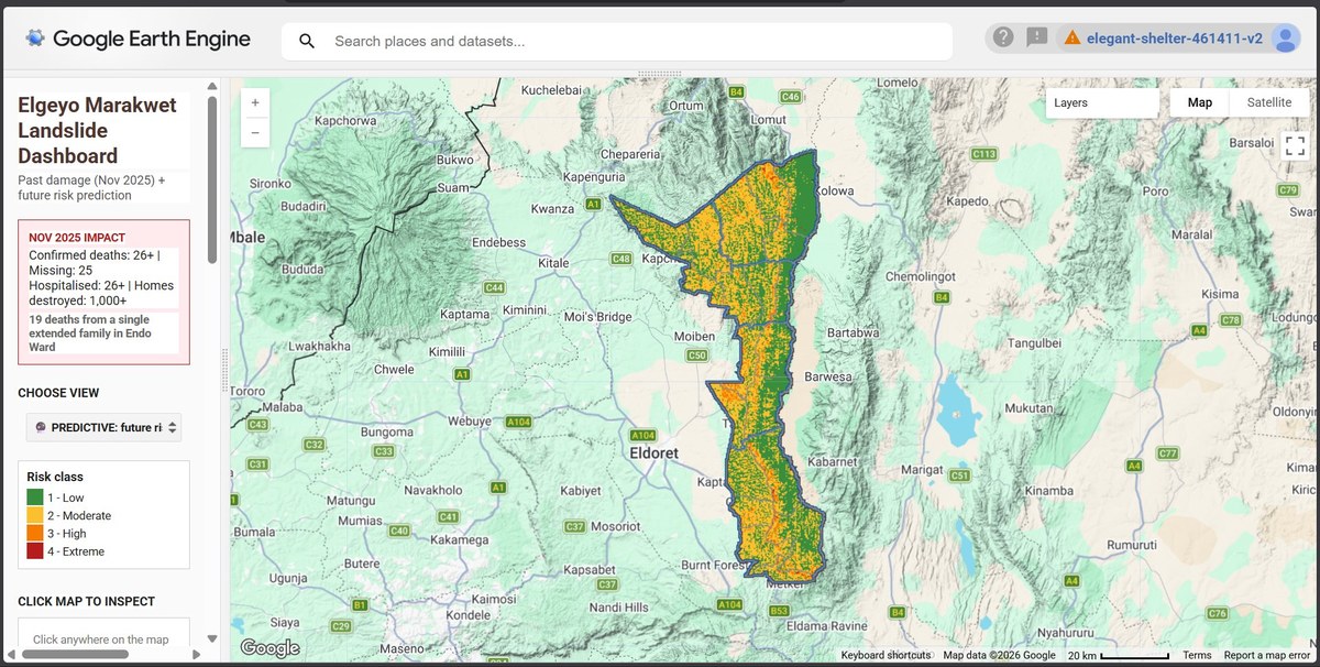
Elgeyo Marakwet Landslide Dashboard
Interactive risk classification across an entire county, built to give disaster officers a heads-up before the next landslide event.
Stack: Google Earth Engine, JavaScript, Sentinel-2, SRTM
-
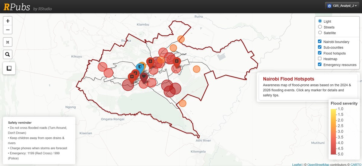
Nairobi Flood Hotspots
Citywide mapping of flood-prone zones, identifying priority areas for drainage, evacuation planning, and infrastructure investment in informal settlements.
Stack: Python, QGIS, Sentinel-1, Google Earth Engine
-
Kenya Climate Risk Dashboard 2025
National-scale web maps showing drought and flood-prone zones across all 47 counties, supporting early warning systems and food security planning.
Stack: Google Earth Engine, Python, Leaflet
Additional work
Two further projects from my work at DRSRS:
- Coffee Farm Geodatabase: end-to-end digitisation and validation of 300+ smallholder coffee farm parcels, improving data accuracy for farmer land management records.
- Cartographic Automation Pipeline: Python and Google Earth Engine scripts to automate repetitive map production tasks, cutting production time across the team's workflow.